Dipl.-Ing. David Mauro, Geospector Munich – article series “Stormwater retention facilities on federal highways”
This article series presents the stormwater retention facilities along Germany’s federal highways, how they work and the challenges involved in operating them (design and function: see Part 1). The second part deals with the measurement problems in determining sediment and sludge in stormwater retention basins, which pose a challenge for the safe and environmentally sound operation of the facilities.
At a glance
For facilities with a permanent pool, measuring sludge is unexpectedly difficult, uncertain and laborious.
Sounding from inflatable boats: often 2–3 person-days per facility.
Accuracy in the centimeter range is required – sub-bottom profilers only achieve decimeters to meters.
Drone-based measurement: a few hours on site, over 95 % of all facilities can be surveyed efficiently.
A seemingly simple question leads to unexpected difficulties
As explained in Part 1, the continuously increasing quantities of sludge and sediment must be checked regularly, as they increasingly impair the basic functions of the facilities. This applies above all to flood protection for downstream water bodies and to preventing pollutants from entering the environment.
To do this, the seemingly simple question of how much sludge there is in a facility must first be answered. If this quantity exceeds the limits specified in the operating regulations, the facility must be cleaned out.
For facilities with permanently impounded water (“permanent pool”), this measurement is unexpectedly difficult in practice and involves great uncertainty and considerable effort.
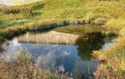
Stormwater retention basin with a permanent pool
Conventional sounding is only possible to a limited extent and provides only estimates
In the simplest case, sounding rods are pushed through the sludge layer down to the bed from the bank; when they are pulled out, the material adhering to them directly shows the sludge depth.
The method can only be used in accessible edge areas. Because of the sloping banks, the deep areas of the basins with the largest sludge accumulations cannot be reached.
Near-natural, shallow facilities can be walked through and sounded in waders. In basins with steep walls and unknown bed depth, however, this is life-threatening at water depths of typically up to three meters and heavy silting.
Jetties are occasionally used as well, but overall the approach is only suitable for initial estimates.
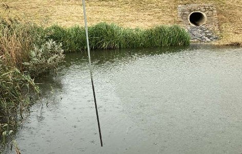
Sounding with a sounding rod from the bank – the deep areas of the basin remain out of reach
Sounding from inflatable boats is very laborious, inaccurate and often impossible
The current state of the art is in fact small inflatable boats from which soundings are taken over as large a part of the water surface as possible. This involves considerable effort: access to the water often has to be created first, and long setup and dismantling times have to be accepted. In addition, several workers must be present at the same time for safety reasons, so a workload of 2–3 person-days per facility is not unusual.
The soundings are usually documented by hand with correspondingly inaccurate position information, which – as we will see later – can lead to large systematic errors in the volume calculation.
Ultimately, however, boats can only be used to a very limited extent if the water surface is not open but overgrown with dense vegetation, especially reed belts.
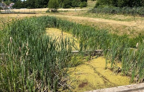
Dense vegetation and reed belts severely restrict the use of boats
Technology for large water bodies can hardly be used
In principle, methods for surveying seas and larger inland waters are an alternative to sounding. It turns out, however, that they can only be used to a very limited extent because of the nature of the facilities.
Sonar measurements, for example, cannot be used in all facilities, as dense underwater vegetation often causes interference through reflections.
The same applies to (costly) airborne bathymetric laser scanning (green laser light penetrates water): especially in the critical settling zones, the water is usually so turbid that measuring down to the sludge surface is often impossible.
So-called sub-bottom profilers, which use special sonar techniques to penetrate and map the soil layers from the water surface, also have accuracies in the decimeter or meter range and are unsuitable for the required centimeter-range accuracy.
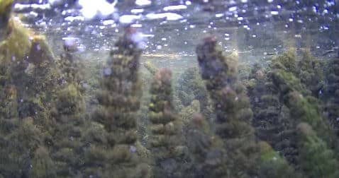
Dense underwater vegetation interferes with sonar measurements
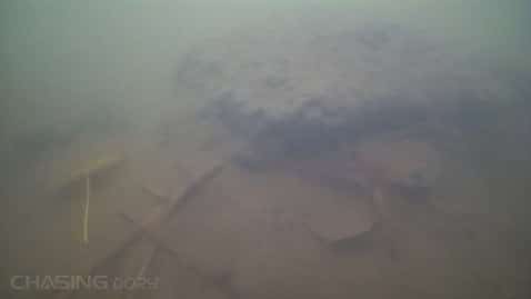
Highly turbid water in the settling zone
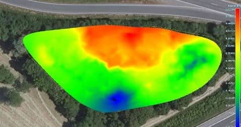
Area-wide measurements are necessary because of the irregular sludge distribution
The distribution of sludge can vary greatly due to different flow velocities and variable bed profiles. Spot measurements at a few points are therefore insufficient; as a rule, measurements must be well distributed over the entire water surface, which is hardly feasible with conventional methods.
Area-wide measured sludge distribution: high (red) and low (blue) deposits lie close together
Conventional calculation methods can lead to grossly incorrect results
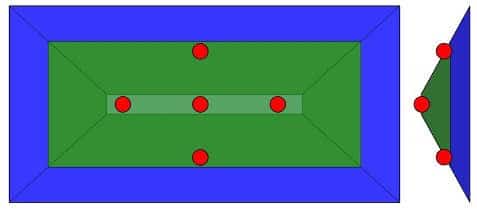
Currently, sludge is usually determined according to the following scheme: soundings at supposedly well-distributed points, calculation of the mean value and subsequent multiplication by the water surface area give the sediment volume.
In small facilities with sloping banks, this can lead to grossly incorrect volumes, as the distribution of the soundings usually favors certain areas and the mean value is no longer representative. The geometry of the bed profile must therefore be taken into account. The article Pitfalls in determining sediment volume shows a sample calculation.
Spot soundings in a basin with sloping banks: plan view and cross-section
The biggest obstacle: inaccurate plans of the bed and missing baseline surveys
Even if a method could be found that can at least measure the course of the sediment surface, there would still be another problem that has so far ruled out the use of intelligent drone sensors, for example: calculating the sludge depth also requires the bed profile (by taking the difference). In practice, however, this is often not known with sufficient accuracy. Hardly any verified plans exist, especially for old facilities, and as a rule no baseline surveys were carried out in the empty state after the facility was built.
Requirements for an efficient method of sediment determination
The above results in the following requirements for a measuring method that, for the first time, should make it possible to survey a wide range of different facility types with little effort:
light, mobile, ready for immediate use
capture of the sediment surface and the bed
complete coverage of the water surface, including inaccessible areas
automated GPS documentation
consideration of the bed geometry
The solution: the latest drone sensors, special methods and continuous further development
The author first became aware of the topic a few years ago through discussions with customers. Because of the difficulties described above, it quickly became clear that a solution would not be trivial. After years of development, patents and a large number of project deployments, the following picture emerges:
Drones are indeed a decisive step toward carrying out sediment determination economically and accurately for the first time. The on-site measurements take only a few hours – compared with up to several days when boats are used. However, this requires special developments, procedures and, above all, experience.
A particular challenge was developing the sensors for capturing the bed profile, since near-natural facilities in particular often have dense vegetation with corresponding root systems in which the originally designed remote-controlled sensors often became entangled.
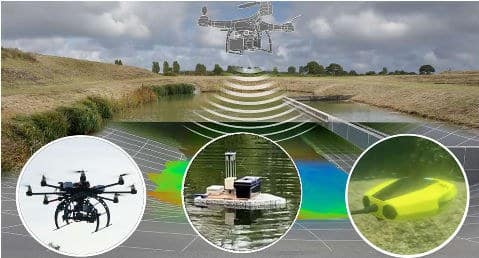
No two basins are alike; each requires an individual approach using a whole portfolio of different airborne, water-borne and ground-based sensors. In fact, the method can efficiently survey over 95 % of all facilities; however, it is continuously being developed and optimized on the basis of the experience gained.
Airborne, water-borne and underwater sensors of the Geospector DTS Acqua
A first overview from drone surveys across Germany
The author is not aware of any comprehensive statistics to date that would allow the cleaning status of the facilities across Germany to be assessed. This is probably due above all to the high effort involved in consistent and systematic measurements, which have therefore tended to be carried out ad hoc as needed.
Newly developed measuring methods using drones and corresponding field deployments in recent years now make it possible for the first time to obtain a comprehensive, systematic picture of the condition of the facilities in Germany.
The third and final part of the article series presents corresponding practical experience, statistics and recommendations derived from them.
Have the sludge depth in your facilities measured?
With the Geospector Sludge Check, we survey the sediment surface and bed of your stormwater retention facilities area-wide by drone – without a boat and without the need for an existing baseline survey.